


Latest Video
News
-

Meteo Curacao uploaded a video (7/5/2024)
Meteorological Department Curaçao
-
Meteo Curacao uploaded a video (7/1/2024)
Beryl Yuli 2024
-

-
Meteo Curacao uploaded a video (5/13/2024)
Meteorological Department Curaçao
-
Meteo Curacao uploaded a video (11/20/2023)
Boletin semanal 20 Nov te ku 26 Nov 2023
Weather Warning
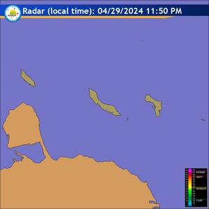
Radar
Satellite (InfraRed)

Forecast
Weather Forecast for Curaçao and surroundings valid until Sunday evening 18:00
l.t., May 31, 2026.
Issued:
Saturday May 30 2026, 17:50 l.t. (21:50 UTC).
Weather:
Clear to partly cloudy sky and a dry condition. Brief cloud increase
tonight with a slight chance of an isolated predawn light shower.
Forecast high will be 31ºC and the low will be 27ºC.
Sunrise will occur at 06:10 and sunset at 18:57.
Winds:
Easterly and moderate to fresh; force 4 to 5 (20 to 39 km/h, 11 to 21
knots). Occasionally strong in gusts; force 6 (40 to 50 km/h, 22 to 27 knots).
Synopsis:
A tropical wave moving westward over the eastern Caribbean Sea today
is expected to pass through our area tomorrow with most of the associated
cloudiness and rainfall activity staying north of the island. Following the
wave''s passage later tomorrow, a relatively thick plume of Saharan dust will
move into the region bringing hazy and drier conditions. However by Monday,
lingering low level moisture and instability may lead to partly cloudy and
occasionally cloudy skies, along with a few passing light showers across the
island from time to time. Additionally during the early part of next week, an
Atlantic high will extend into the eastern Caribbean, once again promoting
breezy conditions.
Sea conditions:
Moderate to locally somewhat rough with wave heights between 1
and 2 meters (3 and 7 feet). The highest wave action is expected over the
northern and eastern open waters. Mariners should continue to proceed with
caution.
Significant tropical weather systems:
None.
Special features:
None.
Outlook until Monday evening:
Partly cloudy and hazy, meanwhile winds strengthen
steadily. A few isolated light showers may occur in the after night.
Forecaster:
Coffie
The next weather forecast will be issued on Sunday 05:00 l.t. (09:00 UTC).